
 Can Tho
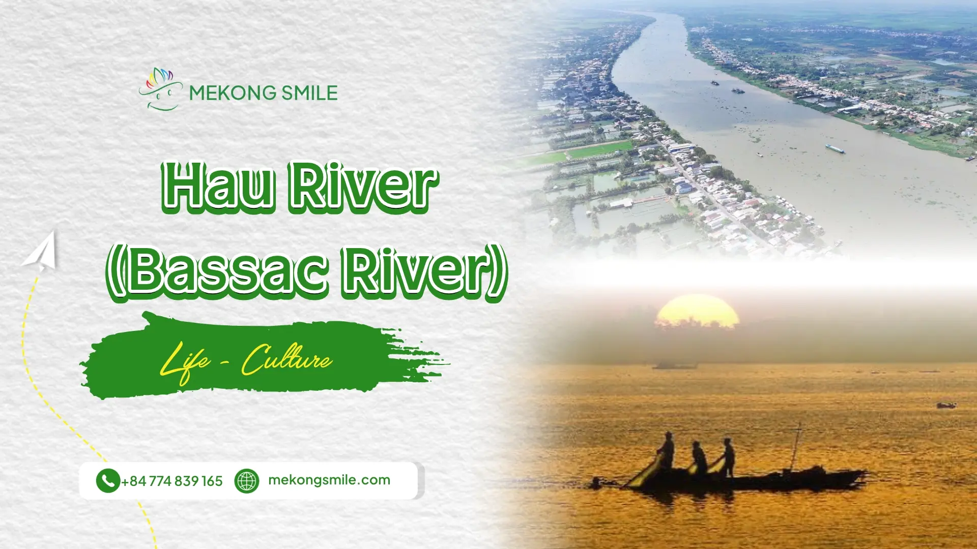
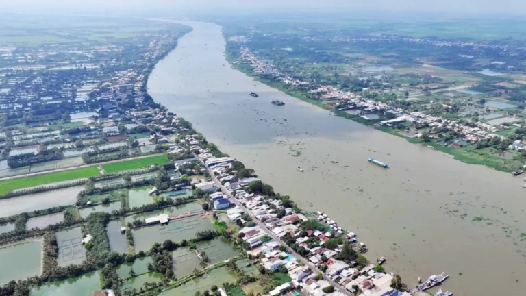
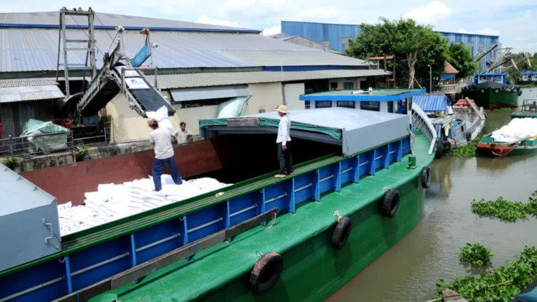

The Hau River, also known as the Bassac River, is one of the main waterways of the Mekong Delta. Flowing from Cambodia into southern Vietnam, it connects river towns, farming communities, busy transport routes, and islands where everyday life remains closely tied to the water.
Along its course, the river takes on different roles. In An Giang, fishing communities, floating fish farms, and riverside markets reflect the importance of freshwater livelihoods. Around Can Tho, cargo vessels share the river with local ferries and sightseeing boats. Farther downstream, the waterways support agricultural communities and connect the delta to its coastal estuaries.
For visitors, the Hau River is more than a place to take photographs. Understanding how people live, work, and travel along the river makes exploring the Mekong Delta a more meaningful experience.
This guide introduces the river’s geography, the communities that depend on it, places worth exploring, and practical ways to experience the Hau River during a trip to southern Vietnam.
Hau River at a glance
| Detail | Information |
| Vietnamese name | Sông Hậu |
| English name | Hau River or Bassac River |
| River system | Mekong River |
| Countries | Cambodia and Vietnam |
| Main Vietnamese river corridor | An Giang, Can Tho, and Vinh Long, continuing toward the delta's coastal estuaries |
| Important river towns and areas | Chau Doc, Long Xuyen, Can Tho, and Tra On |
| Main economic activities | Waterway transport, fishing, aquaculture, farming, trade, and tourism |
| Visitor experiences | Riverside walks, boat cruises, floating fish farms, island communities, and nearby canals |
| Convenient tourism base | Central Can Tho |
| Best general visiting period | Year-round, with drier weather typically from December to April |
The Hau River is not a single tourist attraction. It is an extensive working waterway, and its different sections offer different experiences.
Where is the Hau River?
How the Hau River connects to the Mekong
The Mekong River travels through mainland Southeast Asia before reaching its vast delta.
Near Phnom Penh, Cambodia, a major distributary called the Bassac River branches from the Mekong.
As this waterway enters Vietnam, it is known as the Hau River, or Sông Hậu.
The Mekong system also has another major Vietnamese branch, the Tien River (Sông Tiền). These waterways, together with their connecting rivers and canals, help form the intricate landscape of the Mekong Delta.
A distributary is a river channel that branches away from a larger river, usually within a delta. This is different from a tributary, which flows into a larger river.
The distinction helps explain why the Mekong Delta has so many interconnected waterways rather than one continuous channel.
Where does the Hau River flow in Vietnam?
The Hau River enters Vietnam in the An Giang area, passes river towns such as Chau Doc and Long Xuyen, and continues downstream through the central delta toward the sea.
Along the way, its banks and connected waterways include farmland, urban settlements, industrial and port facilities, river islands, fishing communities, and agricultural areas.
Near Can Tho’s historic city center, the Hau River meets the Can Tho River around the Ninh Kieu waterfront.
Farther downstream, the system connects with the Mang Thit waterway in the Tra On area before continuing toward the Dinh An and Tran De estuarine channels.
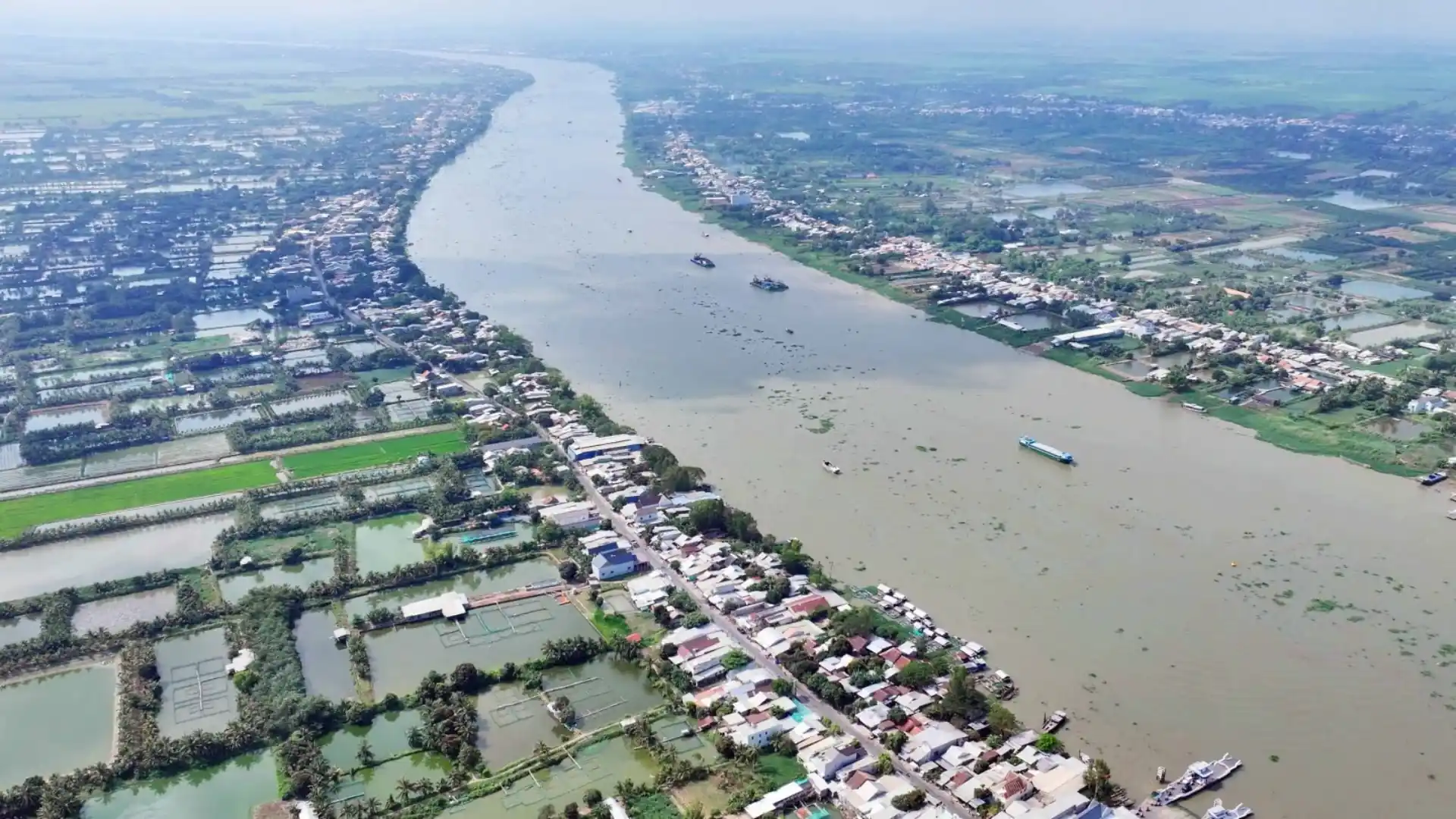
The river’s surroundings change considerably along this journey.
A stretch near a busy city port may be dominated by commercial boats, while a smaller island community may depend more on orchards, fish farming, and local transport.
For travelers, this means that the Hau River cannot be fully understood through one short sightseeing cruise. Each section reveals a different part of the delta’s geography and everyday life.
For a broader geographical introduction, explore our Mekong Delta travel guide.
Life along the Hau River: people, livelihoods, and river culture
The Hau River has supported communities for generations, but life along its banks is neither uniform nor unchanged.
Some residents work directly on the water. Others depend on the river indirectly through agriculture, transportation, trading, or businesses that serve river communities.
Their ways of life also vary from upstream towns to the delta’s lower reaches.
Boats as everyday transportation
Before modern roads and bridges became widespread, waterways were essential connections between settlements in the Mekong Delta.
Small boats carried people between homes, gardens, markets, and neighboring communities. Larger vessels transported agricultural products and other merchandise over longer distances.
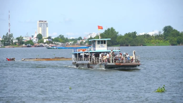
Although road transportation has expanded substantially, boats and ferries remain useful in places where islands, canals, and wide river channels separate communities.
The Vietnamese term đò ngang generally describes a passenger crossing between riverbanks. A đò dọc traditionally traveled along a waterway, sometimes linking several settlements.
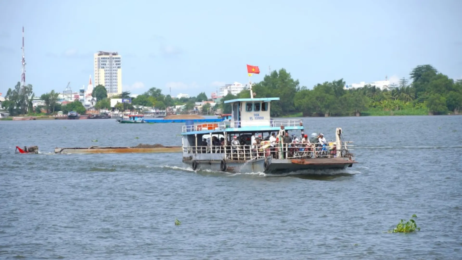
These services served practical purposes: getting people to markets, visiting relatives, reaching work, or transporting everyday goods.
Today, you may see modern motorized ferries alongside smaller wooden boats and private vessels.
A ferry carrying passengers across the Hau River is not necessarily a sightseeing service. For local people, it may simply be part of a regular journey.
The type of boat often reflects the waterway itself. Large cargo vessels use deeper, wider channels, while smaller boats are more practical in narrow canals or at modest riverside landings.
Our guide to traditional boats of the Mekong Delta explains how different Vietnamese vessels developed for transportation, fishing, and trade.
Fishing and floating fish farms
Fishing and fish farming are important livelihoods in several communities along the Hau River.
Fishing households depend on access to aquatic resources, while aquaculture businesses raise fish for domestic consumption and commercial markets.
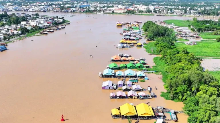
A floating fish farm, often called a bè cá, commonly consists of structures positioned on the river with fish-rearing compartments below the water.
Workers must monitor the fish, manage feeding, maintain equipment, and respond to changing water conditions.
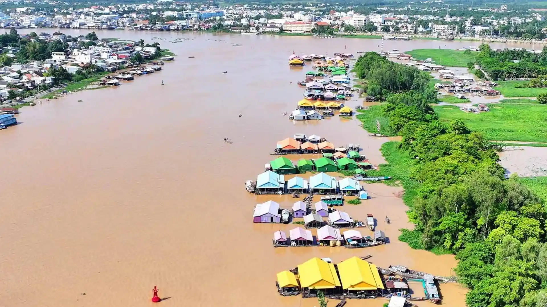
For some households, aquaculture is not simply a source of fish. It is also a family business that provides employment and supports the local economy.
Near Long Xuyen, research by Can Tho University has documented the importance of the river to fish-farming households and fishing communities.
Farther upstream around Chau Doc, floating fish farms and riverside settlements form another recognizable part of the landscape.
Some floating structures have living spaces above or beside fish-rearing facilities, illustrating how closely work and domestic life can be connected.
However, not every floating structure is a tourist attraction, and commercial fish farms are not necessarily open to visitors.
When traveling independently, it is important to distinguish between places that welcome guests and private working areas.
Trading boats and riverside commerce
The Hau River is also a commercial transportation route.
Cargo vessels move goods between river ports, agricultural areas, processing centers, and connecting waterways.
Depending on the location, visitors may see boats transporting produce, construction materials, and other commercial cargo.
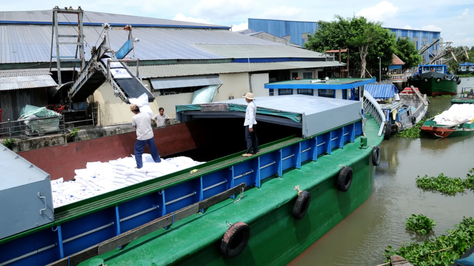
Smaller boats serve local distribution and trade.
Historically, the region’s river network made it possible for traders to transport goods from one settlement to another without relying on extensive road infrastructure.
Some merchants spent considerable time aboard their boats, using them for transportation, storage, and daily activities during trading journeys.
This helped shape the culture of thương hồ, a Vietnamese expression associated with people whose livelihoods involve trading and traveling by boat.
Floating markets developed within this wider commercial system.
Trading from boats was practical where river transport connected farms, villages, and markets.
One recognizable tradition is the cây bẹo: a pole used by some merchants to display examples of the products they sell.
Buyers could identify goods from a distance without needing to approach every boat.
Today, river commerce has changed. Roads, trucks, supermarkets, and modern distribution systems have reduced the role of some traditional trading routes.
At Cai Rang Floating Market, for example, commercial activity continues, but the market has fewer trading boats than in many older photographs, and tourism has become more visible.
Rather than expecting a scene preserved exactly as it was decades ago, visitors can appreciate the market as an example of a trading tradition adapting to changing conditions.
Learn more in our Cai Rang Floating Market visitor guide.
Farming communities and life on river islands
Not everyone living along the Hau River earns a living from boats or fishing.
Agriculture is another essential part of the river landscape.
Water from the river and its connected canals helps support farmland, orchards, and other agricultural activities across the delta.
River islands, locally called cù lao, can contain permanent settlements with houses, gardens, roads, small businesses, and agricultural land.
These are not necessarily isolated islands or untouched natural areas.
Many are established communities where residents travel by road, ferry, or boat depending on local infrastructure.
On Tan Loc Islet, for example, fruit gardens, agricultural activities, traditional houses, and local producers are spread across a large inhabited island.
Around Son Islet, tourism has developed through local households offering experiences connected with fruit growing, food preparation, and river-based livelihoods.
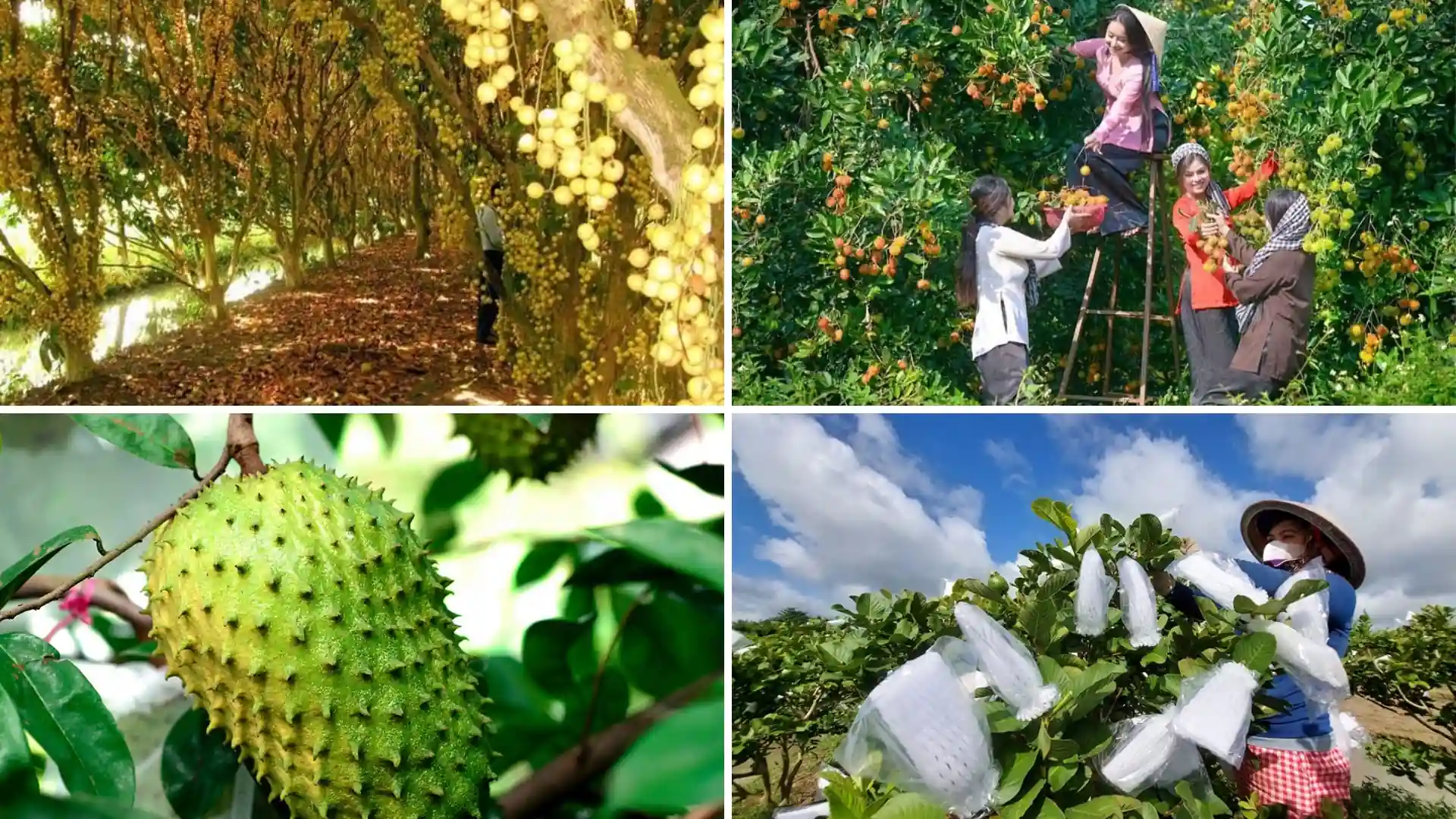
Other islands remain primarily agricultural or residential, with little organized tourism.
The presence of orchards also changes how the river landscape looks throughout the year.
Fruit varieties have different growing and harvesting periods, and not every garden offers the same produce at the same time.
For visitors, a community visit becomes more rewarding when it includes an explanation of how local households use their land and waterways, rather than focusing only on tasting fruit.
Homes, markets, and social life beside the water
The Hau River shapes more than how goods move.
It also influences the arrangement of settlements and the daily routines of riverside communities.
In some areas, houses face the river because the waterway historically functioned as an important route to markets and neighboring settlements.
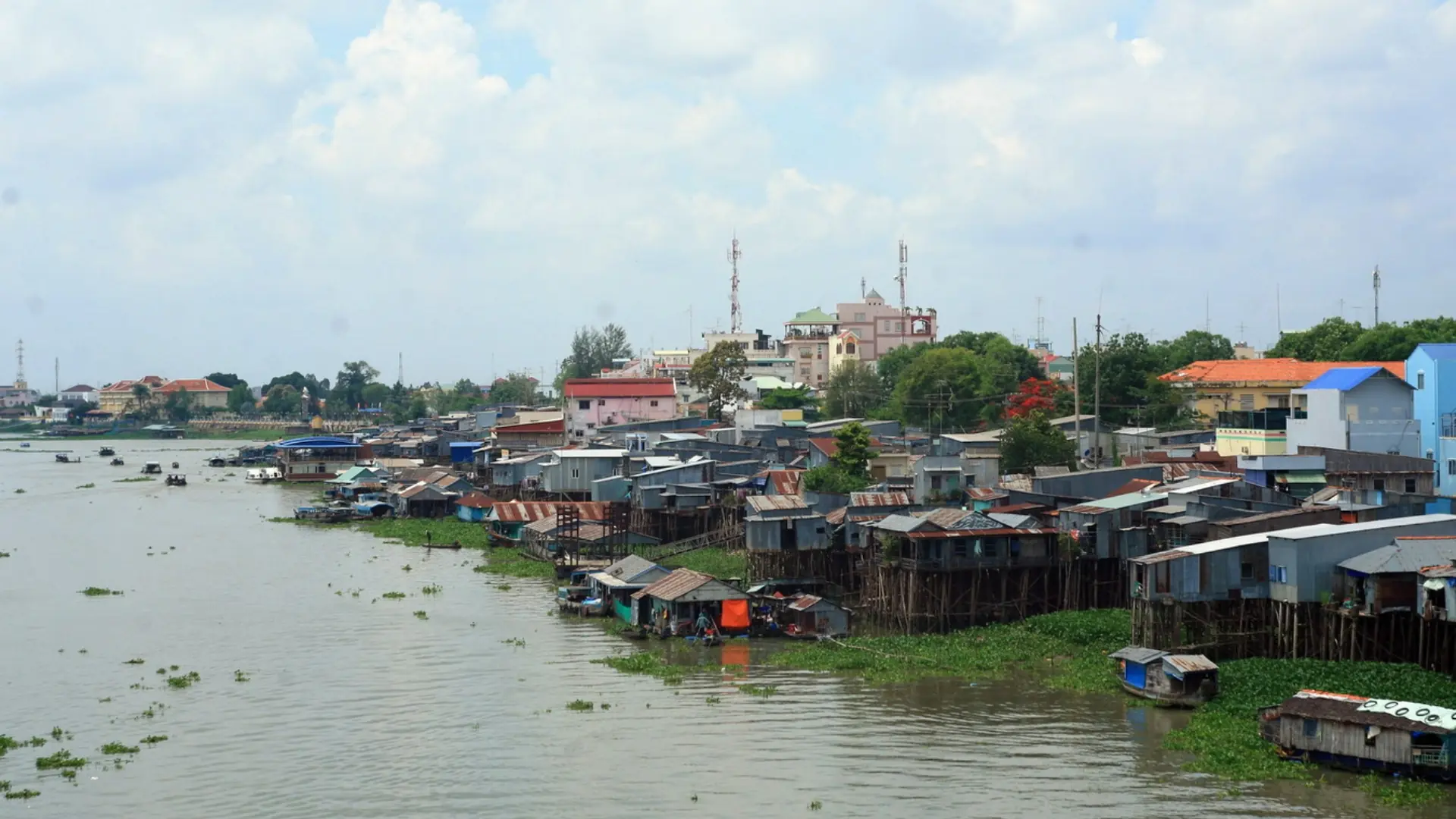
Local landing points provide places to board boats, unload goods, and connect with transport on land.
Riverside markets serve both people arriving by road and those coming from nearby waterways.
Community life can extend into temples, religious sites, family gatherings, and festivals, reflecting the cultural diversity of the wider delta.
The Hau River corridor includes communities with different ethnic, religious, and cultural traditions.
Around Chau Doc, for instance, Cham communities on the opposite side of the river maintain their own religious and cultural practices.
Elsewhere in the delta, Vietnamese, Khmer, Chinese Vietnamese, and other communities contribute to the region’s broader cultural landscape.
These traditions should not be treated as interchangeable or presented as one uniform “river culture.”
Each community has its own history and ways of life.
The river connects many of them geographically, but it does not erase their differences.
How the river influences daily routines
Water levels, seasons, and the type of work people do can influence daily schedules.
A commercial boat crew may plan around cargo handling and navigation conditions.
Fish farmers must maintain their stocks and respond to water quality changes.
Farmers may depend on irrigation, rainfall, soil conditions, and seasonal production cycles.
People using small ferries or river crossings must also account for local operating schedules and water conditions.
These routines differ from the carefully arranged activities of a sightseeing tour.
Visitors often see only a brief part of this working landscape.
A boat passing a fish farm, for example, offers a glimpse of aquaculture, but understanding the work involved requires more than observing the structures from a distance.
This is one reason a knowledgeable local guide can add value to a river excursion: the guide can help explain what travelers are seeing without turning everyday activities into staged attractions.
Riverbank erosion, flooding, and changing livelihoods
Life beside the Hau River also involves challenges.
The river is a dynamic environment. Its water levels, flow patterns, sediment movement, and banks change over time.
Riverbank erosion can threaten houses, agricultural land, roads, and other structures.
Changes in water quality and water availability can affect fishing, aquaculture, and farming.
Farther downstream, the interaction between freshwater and tidal influence adds another challenge for agricultural and coastal communities.
Climate change, development, and changes across the broader Mekong basin are contributing to pressures on the delta’s environment.
At the same time, roads, bridges, new industries, and changing markets have transformed how people work and travel.
Some households have diversified into tourism or services. Others continue traditional livelihoods while adapting their methods.
It would be misleading to describe life along the Hau River as completely unchanged or uniformly peaceful.
The river offers economic opportunities, but communities also face environmental and commercial uncertainties.
For travelers, understanding these realities provides a more respectful perspective on the people who live beside the water.
Communities and landscapes along the Hau River
The Hau River passes through several distinct areas. Exploring their differences is useful for travelers who want to understand more than the central Can Tho waterfront.
Chau Doc: a border river town with diverse cultures
Chau Doc, in An Giang, lies along the Hau River near Cambodia.
Its riverfront includes boats, floating fish farms, markets, and transport connections to nearby communities.
Across the water, areas such as Chau Giang and Chau Phong are associated with Cham communities, mosques, and local traditions.
The town also has a long history as a regional trading center, influenced by its location near the border.
Chau Doc is particularly relevant for travelers interested in river commerce, fishing communities, food culture, and the region’s religious diversity.
Read our Chau Doc travel guide for local attractions and travel-planning information.
Long Xuyen: fishing, aquaculture, and a working river city
Farther downstream, Long Xuyen offers another view of the relationship between urban life and the Hau River.
The surrounding river corridor supports transportation, fish farming, fishing, and agricultural activity.
The wider area includes inhabited islands such as My Hoa Hung, where riverine landscapes and agricultural land are part of the local environment.
Long Xuyen is relevant to travelers interested in understanding the river as an economic resource rather than only as a sightseeing destination.
However, access to fish farms or household businesses should be arranged appropriately; their presence along the river does not mean they operate public tours.
Can Tho: urban river life and island communities
Can Tho is a major urban center on the Hau River and one of the most convenient places for international visitors to explore the river.
Its waterfront combines the activity of a city with views of commercial boats, river crossings, and the main waterway.
Around the historic urban center, visitors can enjoy Ninh Kieu Wharf, cruises near Can Tho Bridge, and excursions to Son Islet.
Beyond the waterfront, connected canals lead into residential and agricultural areas.
This variety makes Can Tho a useful starting point for understanding several aspects of river life without traveling to every section of the Hau River.
Tra On and the lower river
Farther downstream, the Tra On area of Vinh Long lies near the meeting of the Hau River and the Mang Thit waterway.
This part of the delta is associated with agricultural communities and waterborne transport between different branches of the river network.
The landscape includes settlements, farmland, and connecting waterways used for local travel and commerce.
Continuing toward the coast, the lower Hau River system becomes increasingly influenced by tidal and estuarine conditions.
These changing water conditions affect both the natural environment and how communities manage agriculture and other livelihoods.
For travelers considering areas well beyond central Can Tho, separate transport and local arrangements are generally necessary.
There is no reason to assume that one standard Can Tho sightseeing tour covers the entire Hau River corridor.
Things to see and do along the Hau River in Can Tho
For many international travelers, Can Tho is the easiest place to begin.
The following experiences are in or around the city, although they are not all located on the Hau River’s main channel.
1. Walk along Ninh Kieu Wharf
Ninh Kieu Wharf (Bến Ninh Kiều) offers an accessible introduction to Can Tho’s riverside atmosphere.
From the public waterfront, visitors can watch boats moving through the area and enjoy views of the river.
Walking here does not require booking a sightseeing cruise.
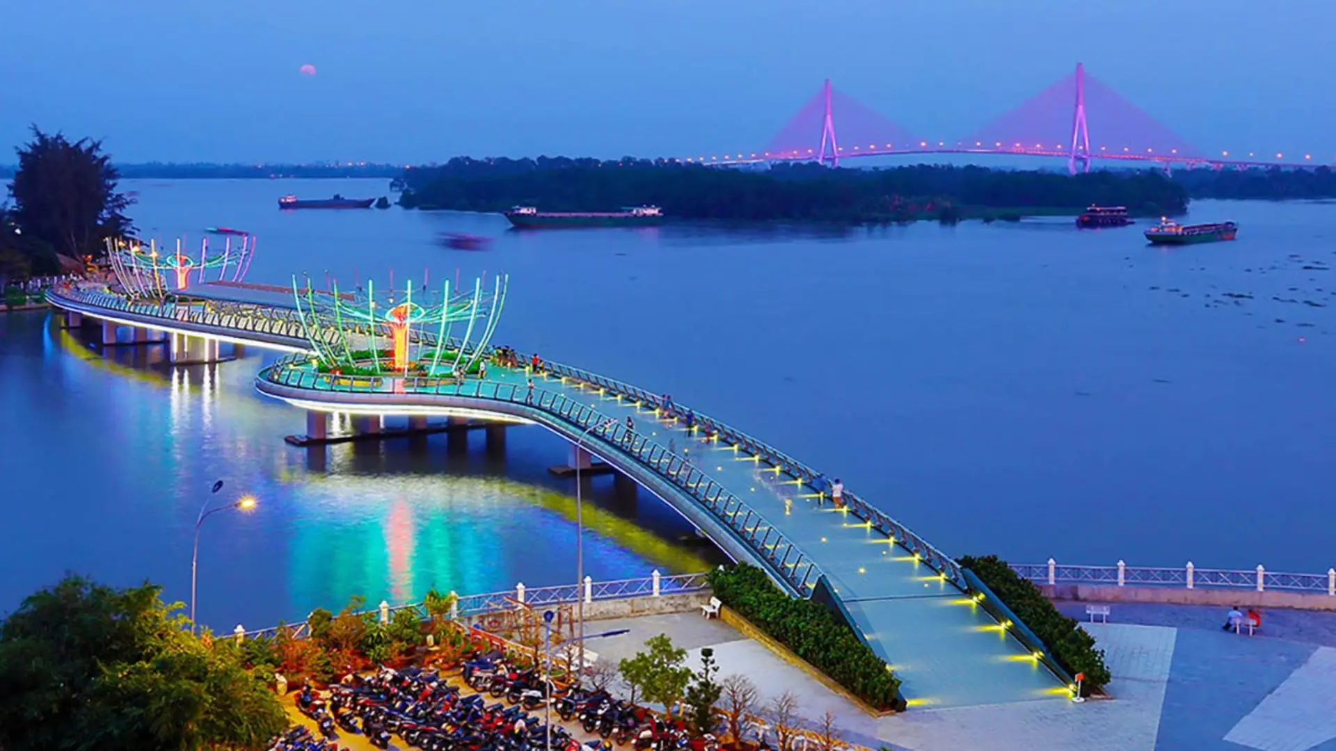
The surrounding streets also provide access to restaurants, markets, and other central attractions.
Late afternoon and evening are convenient times for an unhurried walk, especially for travelers who have spent the day sightseeing elsewhere.
Nearby, Ninh Kieu Pedestrian Bridge crosses the mouth of Khai Luong Canal. Although it offers views toward the Hau River, it does not span the river’s main channel.
For a closer look at the area, see our Ninh Kieu Wharf guide.
2. Visit Son Islet and its floating fish farms
Son Islet (Cồn Sơn) is a river island known for community-based experiences involving local households.
One of the main attractions is visiting floating fish farms and learning about aquaculture.
Depending on the host and itinerary, visitors may also explore fruit gardens, participate in traditional cake-making, taste seasonal produce, or observe other family-run activities.
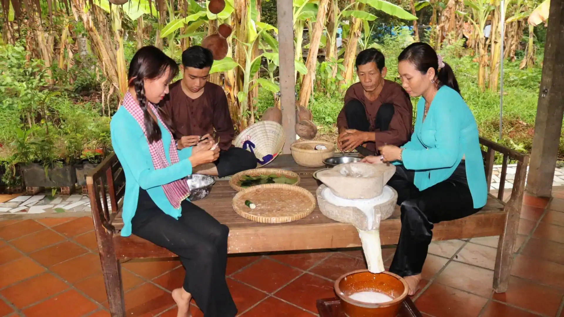
These visits are not identical at every household.
Some activities are organized for visitors and may require advance arrangements or separate payment.
Independent visitors can travel toward Co Bac Ferry Station in the Binh Thuy area to arrange a crossing to the island.
The boat crossing itself generally takes around 5–10 minutes, but this does not include travel from central Can Tho or time spent visiting local households.
A combined community experience is better planned as a half-day outing.
Read more about Son Islet or explore the Son Islet Tour offered by Mekong Smile.
3. See Can Tho Bridge from the river
Can Tho Bridge is a large cable-stayed road bridge crossing the Hau River.
Its pylons and cables create a recognizable landmark along the main waterway.
A suitable boat excursion can offer a perspective that is different from viewing the bridge from land.
From the water, visitors can better appreciate the scale of the structure and the surrounding river traffic.
However, not every boat service passes beneath or near the bridge.
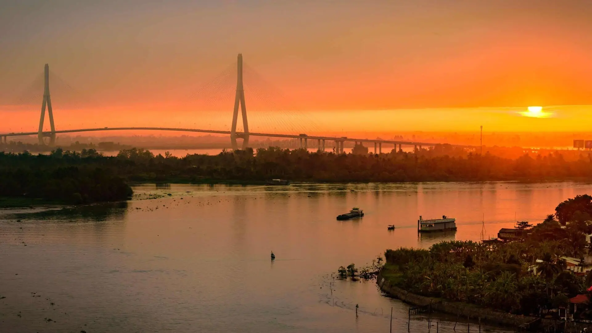
If this view is important to your plans, confirm the route with the boat operator before booking.
4. Explore Tan Loc Islet
Tan Loc Islet (Cù lao Tân Lộc) lies in the Hau River more than 40 kilometers from central Can Tho.
It is a large inhabited island with orchards, farming activities, local producers, and historical houses.
Compared with the more frequently visited Son Islet, Tan Loc requires additional travel time and more independent planning.
Individual gardens and local attractions operate separately. Some may require prior contact.
For travelers interested in agricultural life, rural landscapes, and a less centrally located river island, Tan Loc may be worth considering.
See our Tan Loc Islet guide for more information.
5. Experience Cai Rang Floating Market on a connected waterway
Cai Rang Floating Market is closely associated with the wider river culture of Can Tho.
It is located on the Can Tho/Cai Rang waterway system connected to the Hau River, rather than on the main Hau River channel.
The market is known for trading from boats, including the traditional use of cây bẹo poles to display products.
Today, the market is smaller than it was in the past, and visitor boats are a visible part of the early-morning activity.
Travelers should not expect every historical trading practice to be operating on the same scale shown in older photographs.
The most relevant time to visit is generally early morning.
For detailed travel planning, see our Cai Rang Floating Market guide.
Ways to experience the Hau River
Different river experiences offer different levels of access to local culture, nature, and everyday activities.
| Experience | What to expect | Suitable for |
| Waterfront walk | City river views, passing boats, nearby attractions | Independent travelers and short visits |
| Scenic river cruise | Broad river scenery, bridges, passing vessels | Photography and relaxation |
| Local ferry crossing | Practical transport between riverbanks or islands | Independent travel |
| Community-based island visit | Floating fish farms, gardens, local households | Cultural experiences and families |
| Floating market excursion | Early-morning trading and connected waterways | First-time Mekong Delta visitors |
| Extended river journey | Several river landscapes and destinations, depending on itinerary | Travelers with more time |
A local ferry and a guided sightseeing cruise are different services.
Likewise, a small boat entering rural canals may provide an experience very different from a larger vessel navigating the Hau River’s main channel.
Before choosing an excursion, consider whether your priority is scenery, cultural understanding, food, local activities, or simply spending time on the water.
Scenic and sunset cruises
A scenic cruise is suitable for travelers who want to appreciate the river landscape without visiting several attractions.
Around Can Tho, late afternoon can offer softer light and views of Can Tho Bridge and its surrounding waterways.
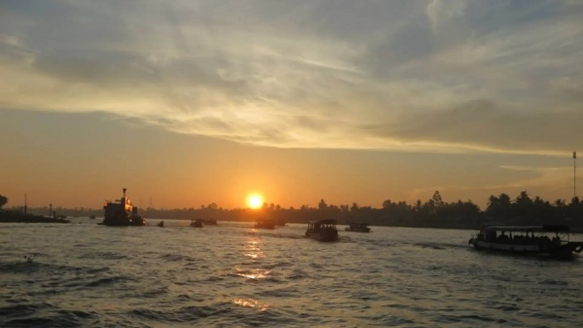
Mekong Smile’s Can Tho Sunset Tour is an approximately two-hour guided experience combining river scenery, canals, and views of the bridge.
The itinerary is weather-dependent, and clear sunset views cannot be guaranteed.
Community-based excursions
A community-based tour focuses on the people and activities associated with the river.
Son Islet is one example where visitors can learn about fish farming, fruit growing, and local food preparation through arrangements with participating households.
These experiences can provide more context than a boat ride alone.
However, activities may vary between hosts, and not all local homes or businesses are visitor attractions.
River and canal combinations
Some tours combine different environments within the same journey.
A route may include a wider river section, smaller connected waterways, a market, and community visits.
The experience depends on the actual itinerary, not simply the phrase “Mekong River tour.”
For example, the Cai Rang Floating Market and Son Islet Tour combines an early-morning market experience with activities on Son Islet.
The full program takes approximately seven hours and covers separate parts of Can Tho’s waterway network.
Suggested itineraries for exploring the Hau River
Option 1: A relaxing waterfront evening
Suggested time: Approximately 1–2 hours.
Start with a walk at Ninh Kieu Wharf in the late afternoon.
Observe the boats and enjoy views across the waterfront before continuing to Ninh Kieu Pedestrian Bridge.
Explore nearby streets or have dinner in central Can Tho afterward.
This is an easy option for travelers who want to experience the riverside atmosphere without arranging a boat excursion.
Option 2: A half-day learning about river communities
Suggested time: Approximately 4–5 hours.
Travel from central Can Tho toward the Binh Thuy area and arrange a crossing to Son Islet.
Visit participating households to learn about floating fish farming, agriculture, traditional food preparation, or other activities that are available for visitors.
The exact stops depend on arrangements with local hosts.
If traveling independently, confirm which households are receiving visitors and whether activities require reservations.
Travelers who prefer transportation and English-language guidance arranged together can consider a guided Son Islet excursion.
Option 3: Explore both the floating market and Son Islet
Suggested time: Approximately 7 hours with an organized itinerary.
Begin early to visit Cai Rang Floating Market while trading and visitor activity is concentrated in the morning.
Continue with other scheduled stops, which may include a local workshop, before traveling to Son Islet for community-based experiences.
Because this journey covers different waterways and destinations, it requires more coordination than a simple scenic cruise.
It is suitable for travelers who want to experience both river commerce and local household activities during one day.
Planning note: These itineraries explore selected areas around Can Tho. They do not cover the entire Hau River from An Giang to the coast.
Best time to visit the Hau River
Dry season: December to April
The dry season generally brings less rainfall and is a convenient period for outdoor sightseeing.
It is particularly suitable for travelers who want to plan waterfront walks, city exploration, and boat trips with fewer weather-related interruptions.
However, temperatures can become high, especially toward the end of the dry season.
Rainy season: May to November
During the rainy season, the surrounding landscape can become greener, and some orchards enter their main harvesting periods.
Rainfall does not necessarily prevent travel, but showers and thunderstorms may affect boat departures or outdoor activities.
Visitors should be flexible when planning routes involving several stops.
Water levels, tides, and river conditions
The Hau River is influenced by both upstream flows and tidal movement.
Water levels can affect boat landings, navigation conditions, and access to certain waterways.
During periods of unusually high water, some low-lying riverfront areas may experience flooding.
These conditions can also change how local communities work and travel.
Always follow current local weather guidance and the instructions of the boat operator.
Morning, afternoon, or evening?
Choose the time of day according to the experience.
Early morning is more relevant for observing floating market activity.
Daytime is suitable for visiting island households, gardens, and participating community businesses.
Late afternoon is appealing for scenic river cruises and photography.
Evening is a convenient time for waterfront walks and selected dining cruises.
There is no single ideal time for every activity along the Hau River.
Practical tips for visiting the Hau River
Choose the right starting point
Different activities require different departure locations.
Ninh Kieu Wharf is convenient for the central waterfront and certain boat services.
Son Islet is commonly accessed through Co Bac Ferry Station in Binh Thuy.
Other excursions may depart from designated piers or include transportation from hotels.
Do not assume that every Hau River boat trip departs from Ninh Kieu Wharf.
Always check the departure point, pickup arrangements, and return location.
Understand what is included in a boat trip
Prices vary depending on whether you are taking a local ferry, joining a shared excursion, or booking a private guided service.
Before confirming a booking, check:
- Whether the price is per passenger or per boat.
- Whether transportation from your hotel is included.
- The planned route and approximate duration.
- Whether the experience includes an English-speaking guide.
- Which attractions and local activities are included.
- Whether meals, refreshments, and entrance fees are covered.
- How the operator handles cancellations or route changes caused by weather.
There is no single entrance ticket or standard sightseeing fare for the Hau River.
Are English-speaking guides available everywhere?
No. Not every attraction, local ferry, independent boat service, or community-run activity provides English-speaking guides or English-language explanations.
Some local hosts communicate primarily in Vietnamese. Others may speak basic English but do not necessarily provide a structured explanation of local history, culture, or livelihoods.
This is particularly important for travelers who want to understand activities such as fish farming, agricultural production, or traditional food preparation.
Mekong Smile’s organized Can Tho Sunset Tour and Son Islet Tour currently list English-language guiding as part of their services.
If you are planning a different experience or need a private English-speaking guide, contact Mekong Smile in advance to discuss suitable arrangements, subject to availability.
Providing your travel dates, destinations, and group size will help the team assess the options.
Safety and responsible travel
Always follow boat crew instructions and use appropriate life jackets.
Take care when boarding or leaving boats, particularly where piers are wet, narrow, or uneven.
For children and travelers with reduced mobility, confirm that the boat and boarding arrangements are suitable before booking.
Avoid entering private homes, fish farms, or working areas without permission.
Ask before taking close-up photographs of residents, especially when they are working or inside their homes.
Do not interfere with fishing equipment or feed farmed fish unless a host specifically invites you to participate.
The Hau River is a working environment as well as a travel destination. Respect for local people and their activities should guide how it is explored.
Frequently asked questions about the Hau River
Is the Hau River the same as the Bassac River?
Yes. Bassac River is the name commonly used for the distributary beginning near Phnom Penh in Cambodia. In Vietnam, the river is known as the Hau River, or Sông Hậu.
Is the Hau River part of the Mekong River?
Yes. The Hau River is one of the main distributaries of the Mekong River system. It carries water through southern Vietnam as part of the Mekong Delta.
Which places are along the Hau River?
Important river towns and areas include Chau Doc, Long Xuyen, Can Tho, and Tra On, along with numerous riverside settlements and islands. These places are spread along a substantial river corridor rather than being stops on one short sightseeing route.
How do local people use the Hau River?
People use the river and its connected waterways for transportation, fishing, aquaculture, trade, and activities supporting agriculture. The importance of each activity varies by location and has changed over time.
Can I travel the entire Hau River by boat?
Navigable sections are used by different types of vessels, but visitors should not assume there is a single scheduled public sightseeing boat covering the entire river. Most tourist excursions focus on a particular area. Longer journeys require itinerary-specific transport arrangements.
Is Cai Rang Floating Market on the Hau River?
The market is on the connected Can Tho/Cai Rang waterway system, rather than the main Hau River channel. It belongs to the wider network of rivers and canals around Can Tho.
Can I explore the Hau River without a tour?
Yes. Public waterfront areas can be explored independently, and local transport services provide access to some river communities. However, visiting individual fish farms, households, or cultural activities may require permission or advance arrangements.
Are English-speaking guides available for river experiences?
Some organized tours include English-speaking guides, but local ferries and independent attractions do not necessarily offer English-language services. Travelers who need interpretation should arrange it in advance.
Explore the Hau River with Mekong Smile
The Hau River is more than a scenic waterway. It connects communities whose livelihoods depend on transportation, farming, fishing, trade, and the changing environment of the Mekong Delta.
From the floating fish farms of An Giang to the river islands and urban waterfront of Can Tho, each area tells a different part of that story.
You can explore some places independently. Others are easier to understand with someone who can explain the local activities, cultural background, and everyday life of the people you meet.
If you would like an English-speaking guide for a Hau River experience, Mekong Smile can help you explore available tour options or discuss a customized itinerary.
English-language guiding is not automatically available at every local destination. Contact the team in advance to confirm suitable arrangements.
Tell us your preferred destinations, travel dates, group size, and whether you need an English-speaking guide.
Our team will help you explore options for visiting Can Tho and other destinations in the Mekong Delta.
WhatsApp: +84 774 839 165
Email: contact@mekongsmile.com
Plan your Hau River experience
Planning Your Mekong Trip?
Get a free, personalized itinerary from our local experts in under 120 minutes.

Get a Free Consultation Leave your contact, we handle the rest.
