
 Can Tho

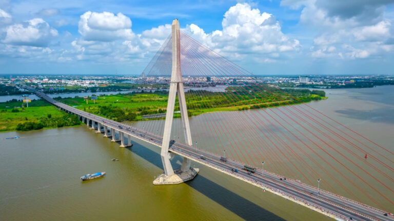

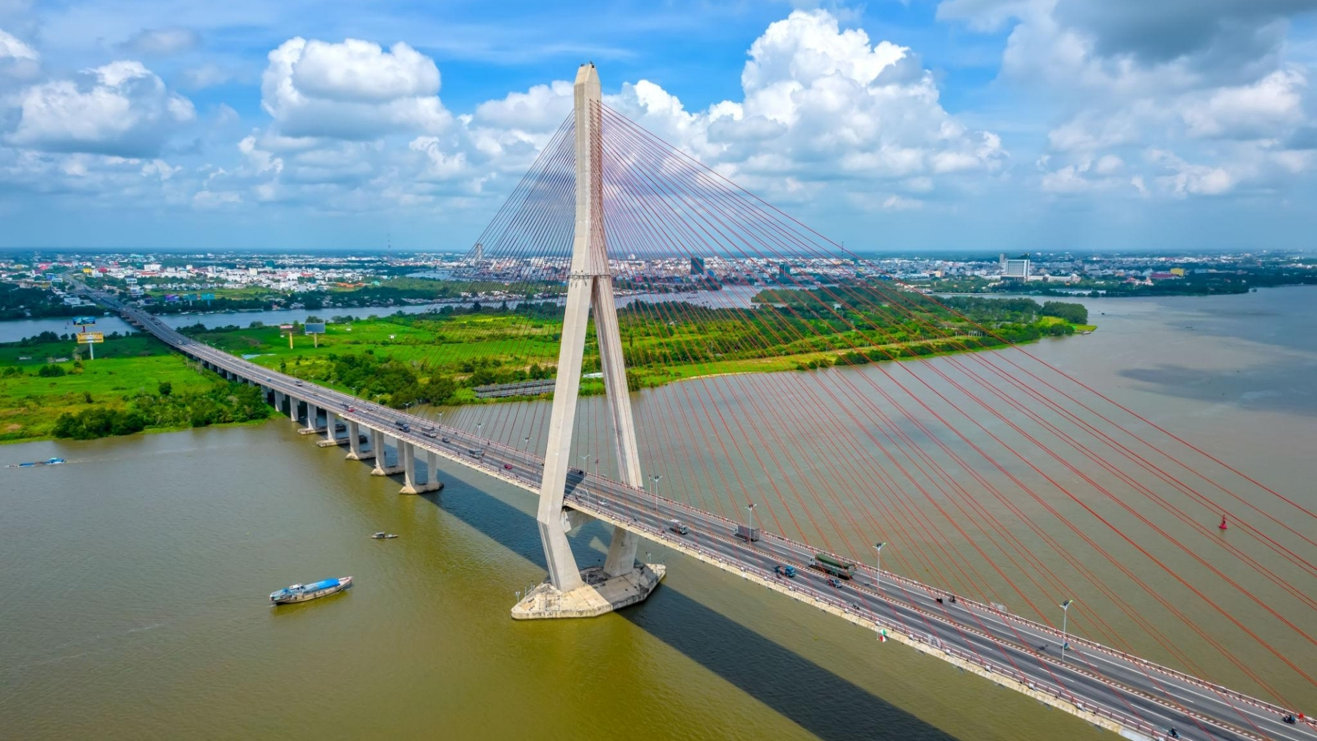
Stretching across the Hau River, Can Tho Bridge connects Can Tho City and Vinh Long Province in Vietnam’s Mekong Delta. Its tall pylons and sweeping cables are a familiar sight along the river, especially for travelers arriving in Can Tho by road or exploring the waterways by boat.
The bridge is an important part of the region’s transportation network, but it also has a place in Can Tho’s riverside landscape. From the waterfront, visitors can see its outline in the distance. From a boat on the Hau River, the structure takes on a different scale as the pylons and cables rise above the water.
This guide covers the history and architecture of Can Tho Bridge, where to see it, when to visit, and what travelers should know before heading out.
Can Tho Bridge at a Glance
| Information | Details |
|---|---|
| Vietnamese name | Cầu Cần Thơ |
| Location | Hau River, connecting Can Tho City and Vinh Long Province, Vietnam |
| Google Maps location | https://s.mekongsmile.com/canthobridge |
| River | Hau River (Bassac River) |
| Bridge type | Cable-stayed bridge |
| Main bridge and approach spans | 2.75 km (approximately 1.71 miles) |
| Main cable-stayed span | 550 m |
| Width | 23.1 m |
| Construction began | September 25, 2004 |
| Opening date | April 24, 2010 |
| Main function | Road transportation across the Hau River |
| Suggested viewing time | Daylight or late afternoon |
The entire bridge construction project, including its connecting approach roads, covers approximately 15.85 km. This is different from the 2.75 km length of the bridge and its approach spans.
Where Is Can Tho Bridge Located?
Can Tho Bridge crosses the Hau River between Can Tho City and Vinh Long Province in southern Vietnam. It connects the Cai Rang area on the Can Tho side with the former Binh Minh area on the Vinh Long side.
The bridge forms part of National Highway 1, an important transportation route through the Mekong Delta.
For travelers arriving from Ho Chi Minh City, Can Tho Bridge may be part of the journey into Can Tho, depending on the chosen road route. Crossing it provides a brief view of the Hau River and the surrounding low-lying landscape.
You do not need to cross the bridge to see it. From central Can Tho, visitors can look toward the structure from the riverside or arrange a boat trip along the Hau River.
If you are staying near Ninh Kieu Wharf, the waterfront is a convenient place to begin exploring the river.
The History of Can Tho Bridge
Before the Bridge: Crossing the Hau River by Ferry
Before Can Tho Bridge opened, ferries were an essential means of transportation between the two sides of the Hau River.
The former Can Tho ferry crossing carried residents, motorcycles, cars, trucks, and goods along one of the Mekong Delta’s important road routes. Travelers heading between Can Tho and Vinh Long had to wait for a ferry rather than continue directly across the river.
This was more than a matter of convenience. The Mekong Delta depends on an extensive network of waterways, roads, and agricultural trading routes. A permanent crossing could improve connections between communities and make the movement of people and goods more predictable.
Can Tho Bridge was developed to provide that connection and reduce dependence on the ferry service.
Construction and Opening in 2010
Construction of Can Tho Bridge officially began on September 25, 2004.
The project received development financing from Japan through the Japan International Cooperation Agency (JICA). Japanese contractors participated in building the bridge, which became a significant infrastructure cooperation project between Vietnam and Japan.
On April 24, 2010, Can Tho Bridge officially opened to traffic.
The new crossing allowed vehicles traveling along National Highway 1 to move directly between Can Tho and Vinh Long without using the former ferry route.
Beyond improving transportation, the bridge introduced a distinctive cable-stayed structure to the landscape of the Hau River.
The 2007 Construction Accident
The history of Can Tho Bridge also includes a serious construction accident.
On September 26, 2007, two approach spans under construction collapsed, causing numerous casualties among workers at the site.
According to an official report published by Vietnam’s Government Portal on October 20, 2007, the accident resulted in 54 deaths and 80 injuries.
The incident led to investigations and further work before construction was completed.
It remains an important and tragic part of the bridge’s history, alongside the infrastructure improvements brought by its completion in 2010.
What Makes Can Tho Bridge’s Architecture Distinctive?
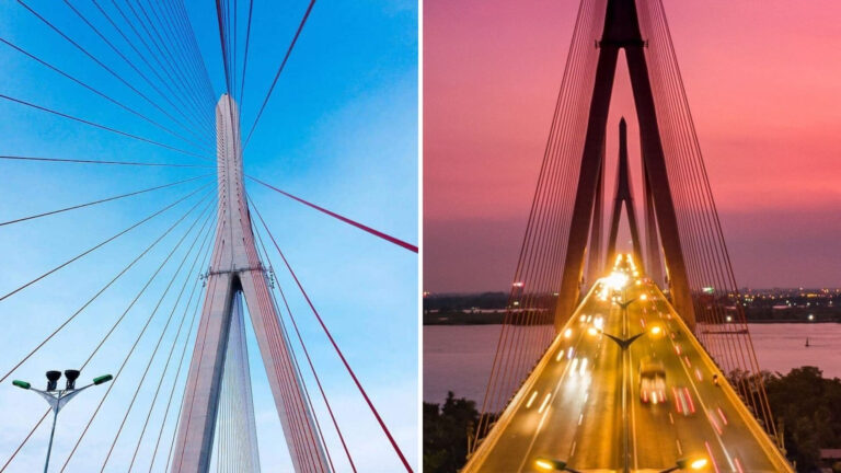
Can Tho Bridge is a cable-stayed bridge, recognizable by its tall concrete pylons and steel cables extending diagonally toward the roadway.
Unlike a conventional bridge supported by multiple short spans, the cable-stayed section uses cables connected to the pylons to support the bridge deck over a long distance.
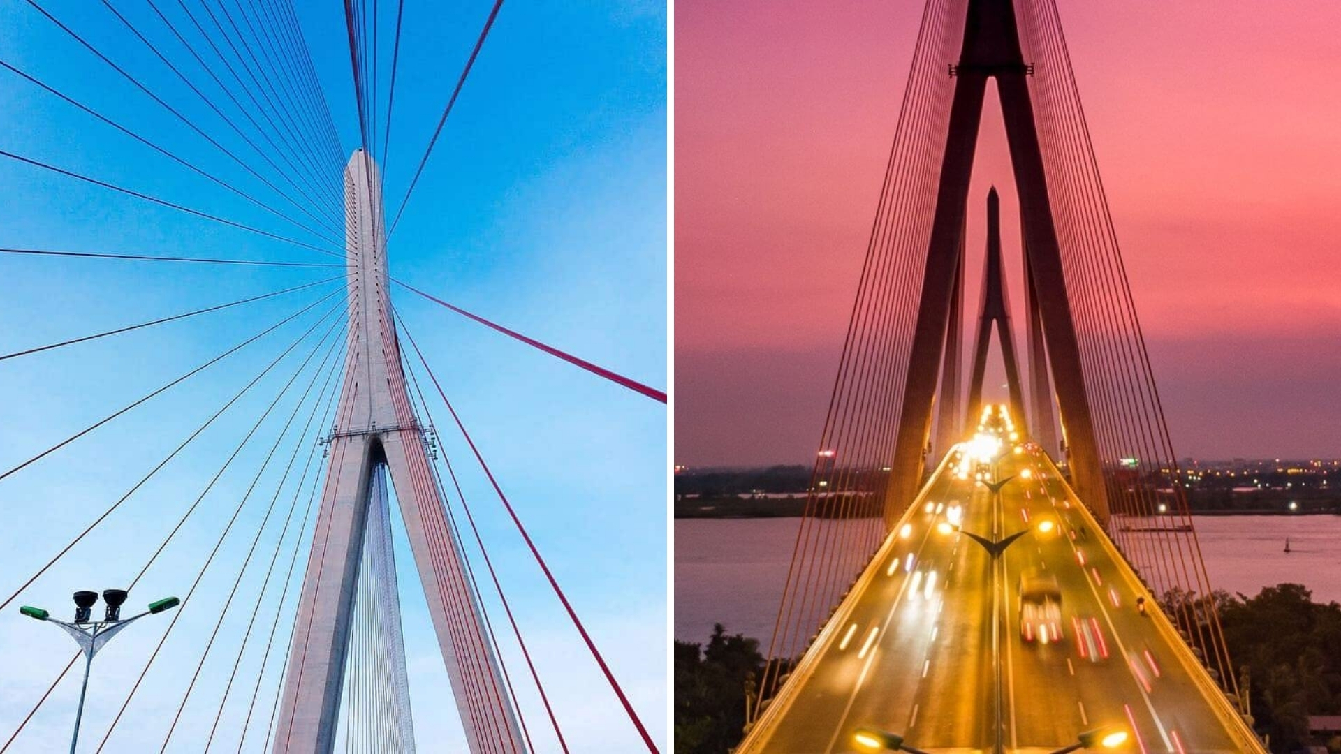
The main span measures 550 meters, providing space for vessels to navigate the Hau River beneath the structure.
From a distance, the diagonal cables form a broad geometric pattern above the water. As you approach the bridge by boat, the arrangement becomes easier to see, with the cables extending from the pylons toward different sections of the roadway.
The bridge measures approximately 23.1 meters in width and was constructed with four vehicle lanes and pedestrian shoulders.
When it opened in 2010, Can Tho Bridge was recognized for having the longest main cable-stayed span in Southeast Asia. That distinction belongs to the period of its inauguration and should not be interpreted as a current record without further comparison.
For visitors who are not particularly interested in engineering, the structure is still worth observing. Its proportions become clearer from river level, where the height of the pylons contrasts with the passing boats and broad waterway.
Where Can You See Can Tho Bridge?
There are several ways to view Can Tho Bridge without making the road crossing itself your sightseeing destination.
From Ninh Kieu Wharf
Ninh Kieu Wharf is a familiar riverside area in central Can Tho, with public walking spaces, boats, and views over the Hau River.
Can Tho Bridge can be seen in the distance from suitable sections of the waterfront, although trees, buildings, weather, and your exact position may affect visibility.
The experience here is less about seeing the bridge up close and more about enjoying it as part of Can Tho’s wider river scenery.
You can spend time watching vessels move along the river, explore the waterfront, or continue toward the nearby pedestrian bridge.
For travelers who have only a short amount of time in the city, this is a convenient way to see the Hau River without arranging a separate journey to the main bridge.
From Ninh Kieu Pedestrian Bridge
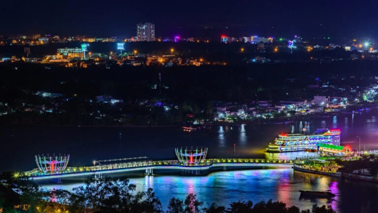
The Ninh Kieu Pedestrian Bridge, also known locally as the Love Bridge, is another place to enjoy river views in central Can Tho.
Located near Ninh Kieu Wharf, this smaller bridge has a curved design and decorative lotus-shaped features. It was built for pedestrians and is a popular place for walking in the evening.
Looking out across the water, visitors can see parts of the riverside landscape, including Can Tho Bridge in the distance when visibility permits.
The two bridges are different structures. Ninh Kieu Pedestrian Bridge is a place to walk and enjoy the waterfront, while Can Tho Bridge carries regional road traffic across the Hau River.
From a Boat on the Hau River
A boat journey offers a closer perspective on Can Tho Bridge.
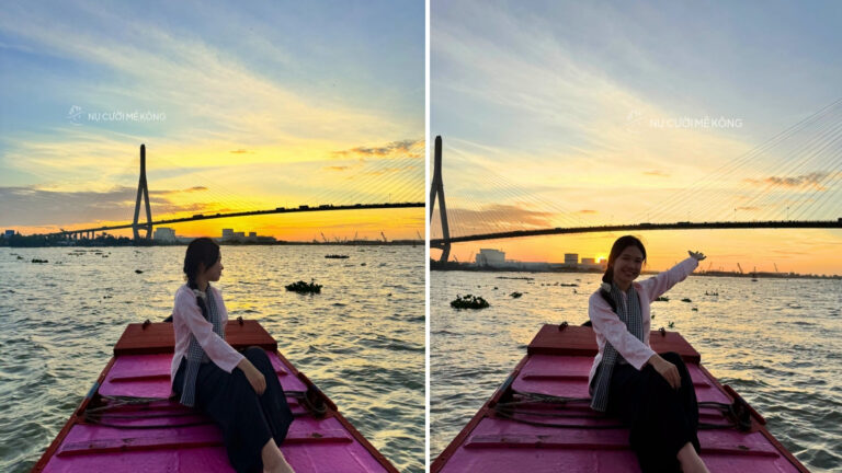
From the water, the bridge’s size becomes more apparent as you approach its supporting pylons. Looking upward reveals the arrangement of the cables, while the deck stretches across the river above passing vessels.
Depending on the route, a boat may travel toward the central section or pass beneath the bridge, giving passengers a view that is difficult to appreciate from the roadway.
The changing perspective is part of the experience. From farther away, the bridge appears as a long horizontal line across the river. As the boat moves closer, the pylons, cables, and supporting structures gradually come into view.
Mekong Smile’s Can Tho Sunset Tour includes views of Can Tho Bridge from the Hau River, along with a boat journey through smaller waterways.
When Is the Best Time to See Can Tho Bridge?
Can Tho Bridge can be viewed at different times of day, and each offers a different experience.
During the Day
Daylight is useful for seeing the bridge’s architectural details.
The concrete pylons, cables, and roadway are easier to distinguish, particularly when the sky is clear.
If you are interested in photographing the structure itself, daytime conditions can help capture the full width of the bridge and its position across the Hau River.
Visibility may be reduced during heavy rain or overcast weather.
In the Late Afternoon and Around Sunset
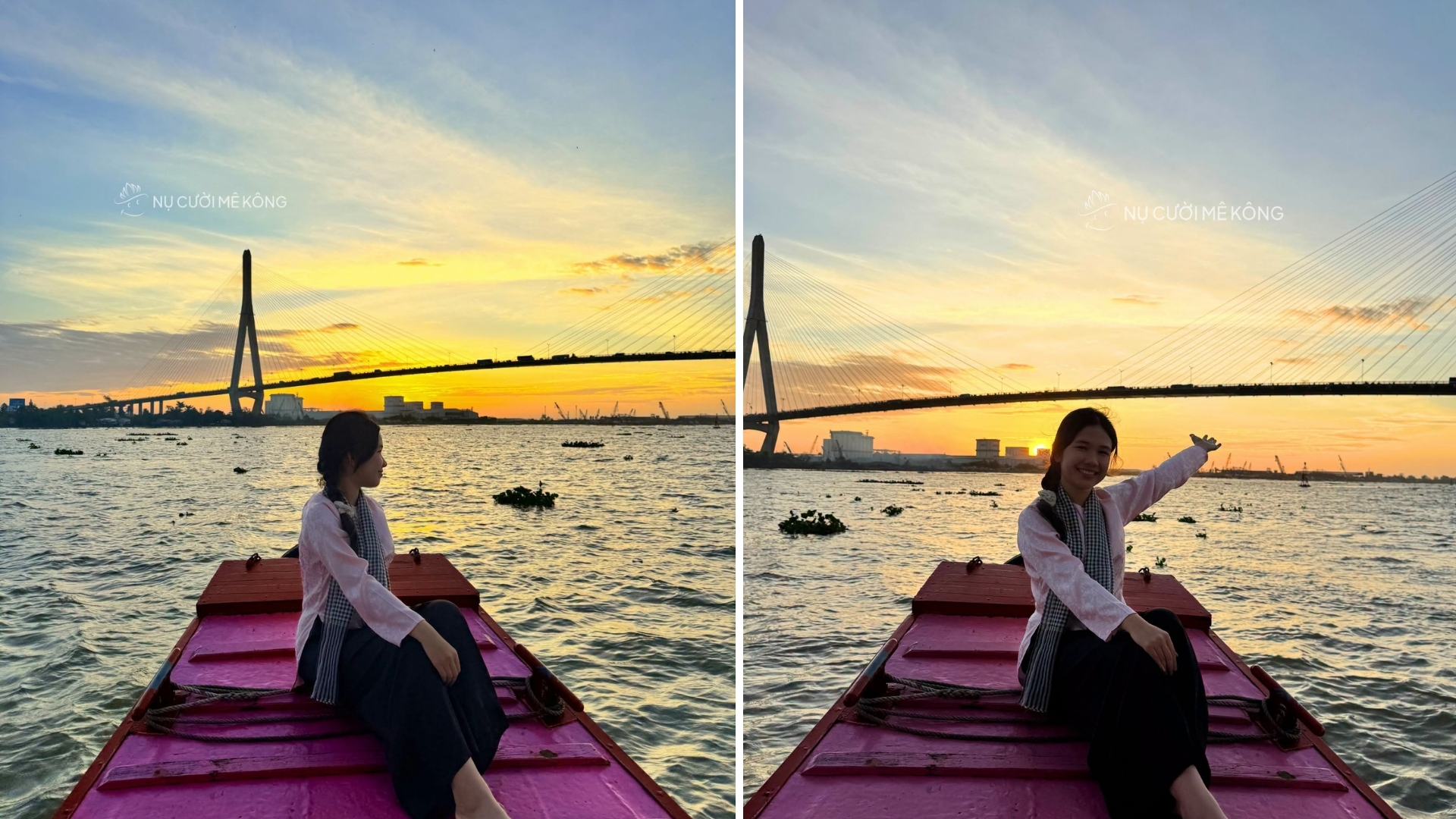
Late afternoon brings softer light to the river and often makes outdoor sightseeing more comfortable than during the midday heat.
From a boat, changing light can alter the appearance of the bridge as the sun gets lower. Its pylons may stand out against the sky, while reflections appear on the water.
The view depends on cloud cover, the direction of the boat, and the weather on the day. A colorful sunset is never guaranteed.
Even without a dramatic sunset, the late-afternoon river scene can be interesting, with boats passing beneath the bridge and everyday activity continuing along the banks.
Can Tho Bridge at Night
After dark, Can Tho Bridge becomes part of the city’s nighttime river landscape.
The roadway and surrounding lights can create reflections on the water, although actual lighting conditions vary.
Visitors should not expect a scheduled decorative light show at the bridge. For evening photography, it is worth checking visibility and choosing a safe riverside location.
If you prefer to walk near illuminated architecture in central Can Tho, the Ninh Kieu Pedestrian Bridge is a separate option to consider.
Can Tho Bridge vs. Ninh Kieu Pedestrian Bridge
Travelers sometimes confuse the two bridges because both appear in photographs and travel guides about Can Tho.
However, they are different in location, design, and purpose.
| Feature | Can Tho Bridge | Ninh Kieu Pedestrian Bridge |
| Location | Across the Hau River between Can Tho and Vinh Long | Near Ninh Kieu Wharf, central Can Tho |
| Main purpose | Regional road transportation | Pedestrian access and riverside recreation |
| Design | Large cable-stayed bridge | Curved pedestrian bridge with lotus-inspired features |
| Opened | April 24, 2010 | February 6, 2016 |
| Visitor experience | Viewed from the river, waterfront, or while crossing by road | Walking, photography, and river views |
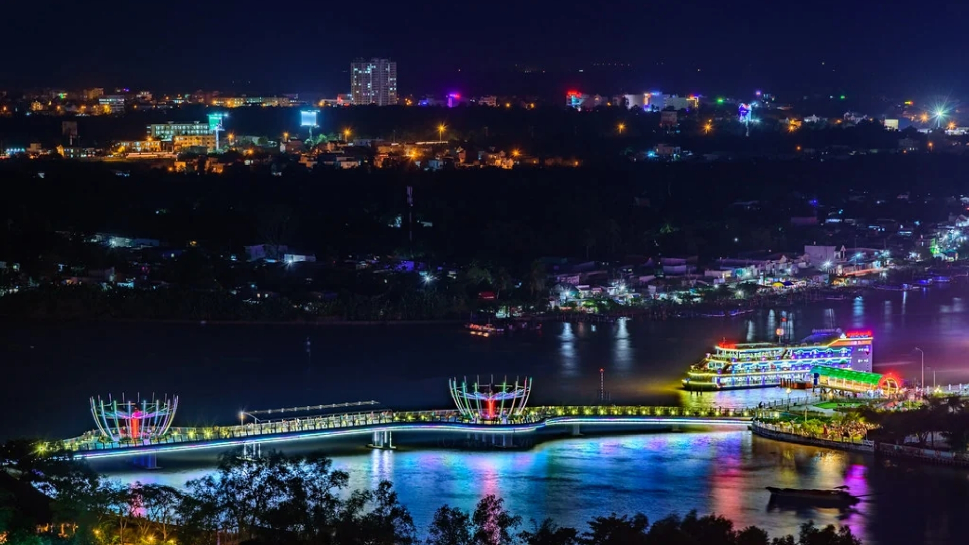
If you are searching for the large bridge with two tall pylons and long cables, look for Can Tho Bridge (Cầu Cần Thơ).
If you want to walk across a smaller bridge near Ninh Kieu Wharf, search for Ninh Kieu Pedestrian Bridge (Cầu đi bộ Ninh Kiều).
Knowing the difference can help you find the correct location when using maps or arranging transportation.
How to Visit Can Tho Bridge
The most suitable approach depends on whether you want to see the structure from the river or simply include it in your journey.
From Central Can Tho
Travelers staying in central Can Tho can visit Ninh Kieu Wharf for a distant view of the bridge.
The waterfront is accessible as part of an ordinary city visit, so there is no need to travel directly to the bridge’s approach roads just to take photographs.
If you are specifically interested in a closer river-level view, look for a boat route that approaches Can Tho Bridge.
Confirm the route with the operator before departure, since not every sightseeing boat follows the same section of the Hau River.
While Traveling Between Can Tho and Vinh Long
Can Tho Bridge is part of National Highway 1 and provides a direct road connection between Can Tho and Vinh Long.
If your route crosses the bridge, you can observe the surrounding scenery briefly from the vehicle.
However, it is not appropriate to stop on the roadway or approach ramps for photographs.
The original bridge design included pedestrian shoulders, but visitors should verify current access arrangements and follow posted signs rather than assume these areas are available for sightseeing.
For a relaxed walk with river views, the Ninh Kieu Pedestrian Bridge is a more practical destination.
Practical Tips for Viewing Can Tho Bridge
Choose your viewpoint first: For a distant view, start at the Ninh Kieu waterfront. For a closer look at the structure, consider a boat journey on the Hau River.
Check the weather: Heavy rain, thunderstorms, and reduced visibility may affect photography or boat schedules.
Follow transportation safety rules: Do not stop on the bridge or its approach roads for photographs. Respect any restrictions on pedestrian access.
Prepare for sun and heat: If you plan to spend time outdoors in the afternoon, bring water and sun protection.
Keep your camera ready on the river: The appearance of the pylons and cables changes as your boat approaches, so photographs taken from different distances can show different details.
Confirm boat arrangements: Ask whether the route approaches or passes beneath Can Tho Bridge. Weather, river conditions, and operating requirements may affect the journey.
See Can Tho Bridge from the Hau River
One way to appreciate Can Tho Bridge is to experience it as part of a wider journey along the Hau River.
While the bridge represents modern transportation, the water below remains an important setting for everyday life in the Mekong Delta. Local boats, river traffic, and communities along the banks create a different perspective from the road above.
The Can Tho Sunset Tour by Mekong Smile combines a boat trip through smaller waterways with views of Can Tho Bridge and the surrounding river scenery.
The approximately two-hour experience also includes a light snack and a drink. The route and sunset conditions depend on the weather, water levels, and operational arrangements.
For travelers interested in seeing more of the city, the Can Tho Travel Guide covers other attractions, food experiences, and practical information for planning a visit.
Can Tho Sightseeing Tours with Culinary Experiences


















Attractions in Mekong Delta
From $601,500,000₫
9:00 AM or 2:00 PM • 5 hours (approx.) • Community-based tours




























Attractions in Mekong Delta
From $842,100,000₫
6:00 AM • 7 hours (approx.) • Community-based tours













Attractions in Mekong Delta
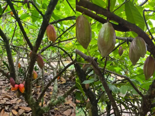
Cai Rang Floating Market Tour: Cacao Farm, Fruit Garden & Canals
From $561,390,000₫
06:00 AM • 5-6 hours (approx.) • Sightseeing & Leisure Tours








Attractions in Mekong Delta
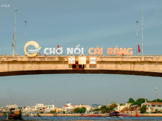
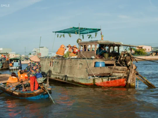
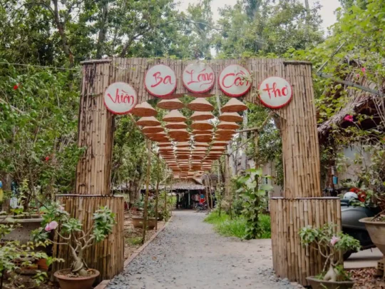
Can Tho Floating Market & Fruit Garden Tour: Mekong Tropical Sense
From $441,100,000₫
06:00 AM • Approximately 4-5 hours. • Sightseeing & Leisure Tours
Can Tho Bridge: Frequently Asked Questions
Where is Can Tho Bridge located?
Can Tho Bridge crosses the Hau River between Can Tho City and Vinh Long Province in Vietnam’s Mekong Delta. It forms part of National Highway 1.
How long is Can Tho Bridge?
The bridge and its approach spans measure approximately 2.75 km. The overall construction project, including connecting roads, extends approximately 15.85 km.
When was Can Tho Bridge built?
Construction began on September 25, 2004, and Can Tho Bridge officially opened to traffic on April 24, 2010.
What happened during the construction of Can Tho Bridge in 2007?
On September 26, 2007, two approach spans collapsed during construction. An official government report dated October 20, 2007, recorded 54 deaths and 80 injuries.
Can visitors walk across Can Tho Bridge?
The original design included pedestrian shoulders, but current access conditions should be checked locally. Visitors should follow traffic signs and avoid using the bridge as a photography stop. Ninh Kieu Pedestrian Bridge is a more suitable option for a riverside walk.
Can you see Can Tho Bridge from Ninh Kieu Wharf?
Yes. Can Tho Bridge is visible in the distance from suitable locations along the Ninh Kieu waterfront, although weather and surrounding structures can affect the view.
Can you see Can Tho Bridge from a boat?
Yes. Some boat journeys on the Hau River approach or pass beneath Can Tho Bridge. Confirm the route with your boat operator before departure.
Is Can Tho Bridge the same as Ninh Kieu Pedestrian Bridge?
No. Can Tho Bridge is the large cable-stayed road bridge connecting Can Tho and Vinh Long. Ninh Kieu Pedestrian Bridge is a smaller walking bridge near Ninh Kieu Wharf in central Can Tho.
Planning a visit to Can Tho or looking for a river experience? Contact Mekong Smile for help choosing an itinerary that suits your schedule and interests.
Planning Your Mekong Trip?
Get a free, personalized itinerary from our local experts in under 120 minutes.

Instant WhatsApp Support
Itinerary Tailored to Your Needs
Get a Free Consultation Leave your contact, we handle the rest.
